Mapping Diamond Heights
By the official end of the Redevelopment Agency project in 1978, the population in Diamond Heights had increased from 374 to 7,300 and 2,265 new housing units had been built in the 325 acre project area.
Architect Designed
Architect-designed properties in Diamond Heights.
Developer Built
Developer-built properties in Diamond Heights.
Paper Streets
1899 San Francisco Sewer System and Topography Map, indicating the steep hills of Diamond Heights and the gridiron paper streets. [David Rumsey Map Collection. Cropped and annotated by Hannah Simonson.]
Natural Topography
1938 composite aerial photograph of San Francisco, illustrating the undeveloped hills of Diamond Heights. [San Francisco Public Library, courtesy of David Rumsey Map Collection. Cropped and annotated by Hannah Simonson.]
San Francisco Grid

Diamond Heights is just south of Twin Peaks, near the geographic heart of San Francisco.
Years Built
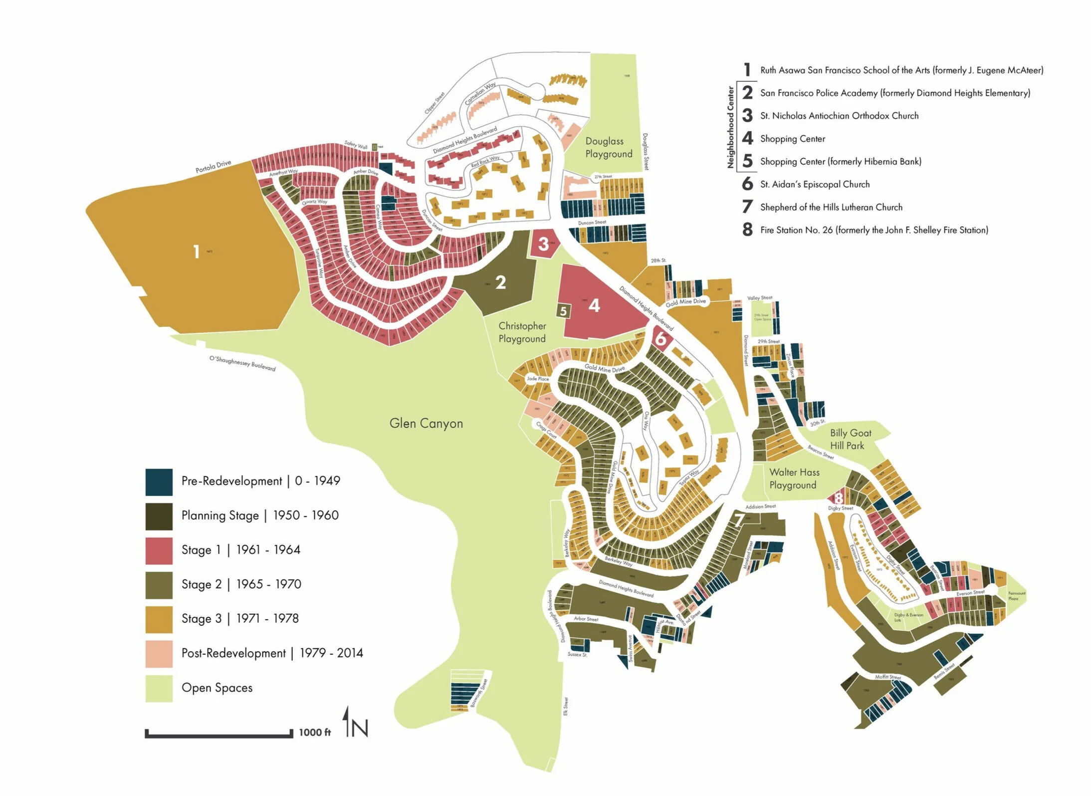
Year of construction for parcels in Diamond Heights. Click to download PDF.